
It takes a flight of nearly 20 hours to get from Ohio to Nairobi, Kenya, where students and an alumna from Kent State University’s College of Public Health are making an impact on the lives of people who reside in the slums.
The team is collaborating on a project that uses a geographic information system (GIS) to analyze risk factors in communities in Kenya.
With help from Andrew Curtis, Ph.D., professor of geography and co-director of the GIS and Health and Hazards Lab at Kent State, current Ph.D. candidates Sandra Bempah and Lorriane Odhiambo, and master of public health student Alka Pandit, are using geographic techniques to provide a different context of prevailing health issues in Mathare, Kenya.

The Mathare slum is well-known for sanitation problems, water access and the challenges associated with access to basic social amenities. This team of students is using their work in GIS to provide a deeper understanding of these issues and to work toward a higher quality of life for the people living there.
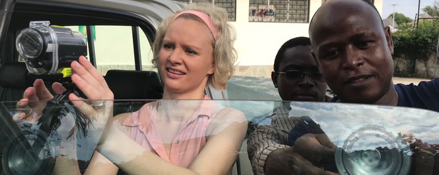
The team is currently collecting data through spatial videos (SV) and spatial video geonarratives (SVG), which are novel mapping approaches developed by Dr. Curtis, to obtain fine scale data enriched by the perspective of residents describing the health issues that impact their community. The cameras can collect data using a variety of approaches, including on foot and by car, bike, motorbike or even boat.
“While these two techniques involve the use of GPS-enabled cameras, SVG has the added advantage of including interviews, too,” Ms. Bempah says. “So, with SVG, we have a community member narrate their ‘story’ about the health problem, while we simultaneously take video of the environment.”
During data analysis, the team digitizes environmental risk factors, such as trash, stagnant water, open drains and other factors that contribute to infectious diseases.
“There are a lot of risk factors for infectious disease — children playing in mud, street vendors located close to trash and sewage sites and stagnant water,” Ms. Bempah says. “We feel that through our risk analysis of these locations, we gain a better understanding of infectious disease epidemiology.”
Ms. Odhiambo, who is a national of Kenya, originally spearheaded the data collection process in 2013. She says she identifies with the challenges in an environment like the Mathare slum.
“I went to school near Mathare,” Ms. Odhiambo says. “I saw some of the problems that people were faced with every day; and today, some of these preventable environmental issues still remain.”
After Ms. Odhiambo set up the framework for the data collection, Ms. Bempah decided to revamp the project after she enrolled in the Ph.D. program in geography and had access to the data through the GIS Health and Hazards Lab.
“Growing up, I’ve always been interested in art and science,” Ms. Bempah says. “GIS is the best field to apply both. I’m a visual person, so GIS really helped me to hone my skills.”
As a national of Ghana, another developing country, Ms. Bempah says she could easily relate with Ms. Odhiambo's passion for the project.
“Having come from such a place, where the risk factors are so high, I can relate to the work I’m doing,” she says. “And I feel that we can make an environmental impact.”
The team is now in collaboration with Dr. Amy Robyn Krystosik, a Ph.D. graduate from Kent State’s College of Public Health, who is currently in Kenya working on her postdoctoral fellowship with Stanford University.
“When I started working on this project in Kenya, I thought of Dr. Curtis because we have a lot of data on arboviruses in four locations in Kenya, and we wanted to have a better environmental context on what the risk factors are for transmission,” Dr. Krystosik says. “So I reached out to him, and we started working on a collaboration.”
Dr. Krystosik is working in Kwale County in Kenya as part of an ongoing longitudinal study (2014-2018) of arboviral transmission in healthy communities and a new intervention project that focuses on children in schools and mothers at home to try to understand and reduce risk factors for disease vector abundance.
“The idea is to measure the impact of our intervention and to give environmental context to intervention efforts as a whole,” Dr. Krystosik says. “So it’s just adding another layer to the ongoing projects.”
For the Mathare slum project, the team has data collected from 2013 to 2015, and has continued to collect data since last December. At the moment, Ms. Bempah says they are collecting only data from spatial videos but are looking forward to start collecting spatial video geonarratives to provide a deeper context to the problem and serve as a motivation for financial sponsorship to start potential interventions.
Dr. Krystosik says that through this work, she believes that she and others can make effective change.
“When you look around our environment, there is a lot of inequalities,” Dr. Krystosik says. “This can be based on your socioeconomic status, your race, your gender — and I don’t think that’s right. We can do better. If we study the problem, collect data and report, we can affect policy makers’ decisions on where to put their resources and make change over time.”